Aerial photography offers unique perspectives that traditional ground-based photography cannot achieve. Whether used in real estate, environmental studies, tourism, or commercial projects, it provides a compelling way to showcase properties, landscapes, and developments. High-quality aerial images provide detail and perspective that enhance marketing materials, strengthen brand credibility, and help businesses stand out in competitive industries. In the private sector it also conveys a sense of professionalism—demonstrating that a company is well-funded, forward-thinking, and serious about presentation.

A key advantage of aerial photography is its ability to present a subject from a completely different vantage point. It expands perspectives and enhances visual storytelling by capturing expansive views, illustrating spatial relationships, and highlighting features that are often overlooked at ground level. There are several client categories that make excellent use of aerial photography:
Real Estate and Commercial Property Marketing:
High-quality aerial photographs allow me to showcase not only a property but its surroundings, emphasizing its accessibility, nearby amenities, and overall location appeal. Potential buyers or investors gain valuable insights into the neighborhood, proximity to major highways, and available infrastructure.


Construction and Infrastructure Documentation:
Aerial photography captures large-scale projects such as roads, bridges, rail trails, and commercial developments. These images help stakeholders understand the scale of a project, its integration into the surrounding environment, and its impact on the community. It can also be used for interesting birds eye view shots of buildings under construction that one could never see from the ground.

Cityscapes:
Arial photography provides a compelling presentation of cities, coastlines and other geographic features. Tourism boards, Urban Planners, Chambers of Commerce and Business entities often use aerial images to highlight the beauty of cities, urban landscapes, and to promote industries.


Environmental and Land Use Planning:
Photographers working in environmental conservation use aerial imagery to document things such as coastline changes and urban expansion. This type of photography provides a valuable resource for researchers, urban planners, and conservationists.


Tourism Promotion:
Arial photography provides a compelling presentation of natural landscapes, historic sites, and cityscapes and is used extensively in tourism by both private and public entities. It is also excellent for large-scale events such as festivals, marathons, or corporate gatherings to capture crowd dynamics, venue layouts, and the overall atmosphere.


Drone vs. Helicopter
People often ask if I use drones but I prefer helicopters for high-quality aerial imaging as they offer several advantages. First, they allow me to use professional-grade cameras with better optics, and interchangeable lenses for greater detail, sharpness, and dynamic range. Second, helicopters can legally fly at much higher altitudes, capturing broader overviews of neighborhoods, landscapes, and infrastructure networks. Third, many urban and high-traffic areas have airspace restrictions that prevent drone operations. Lastly, it surprises people, but a licensed, fully equipped and insured drone operator costs the same as a helicopter - and I can do a lot more and provide a better end product with a helicopter.
The three pictures below - all taken from a helicopter - demonstrate the range I can achieve.

I can get much higher than a drone for expansive views of projects, infrastructure or geography.

I have the ability to get mid range shots such as this housing project and its immediate surroundings.

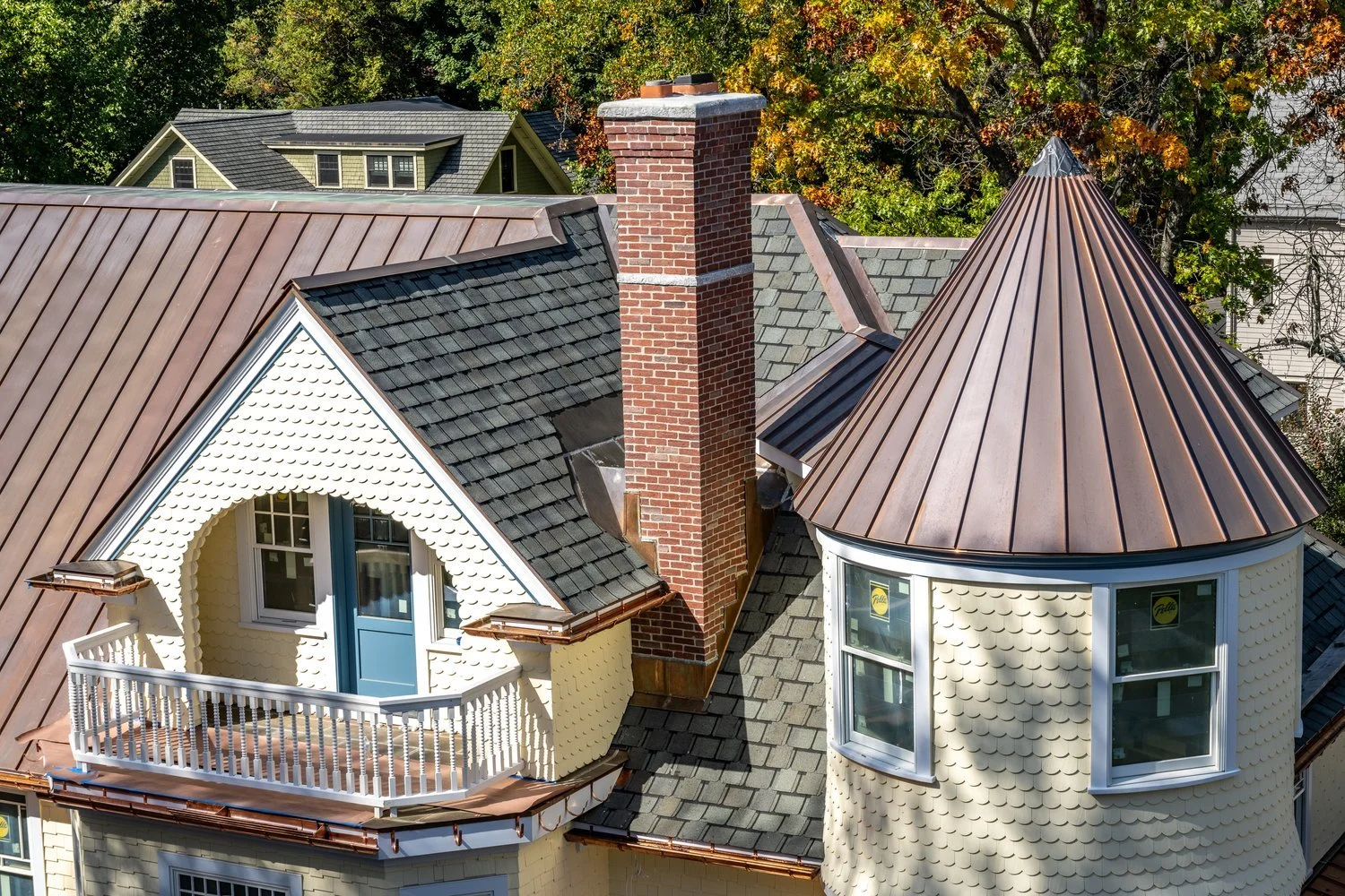
What is surprising to most is that I can also get extremely close-in detail shots, in this case we had staged this deck prior to the flight.
Arial photography expands perspectives and enhances visual storytelling by capturing expansive views, illustrating spatial relationships, and highlighting features that are often overlooked at ground level. For industries such as real estate, construction, tourism and urban planning, aerial photography is more than just a visual enhancement; it is a crucial component of documentation, planning, and decision-making. In a world where first impressions matter, the ability to provide stunning, high-quality aerial images can be a game-changer for my clients.
Aerial photography offers unique perspectives that traditional ground-based photography cannot achieve. If I can help please call me and let’s get you on the schedule.